
Schools close due to winter weather warnings

The threat of wintry weather had two of Gonzales County’s three school districts cancelling classes for both Thursday, Feb. 3, and Friday, Feb. 4, as well as canceling all extracurricular activities for those days.
Gonzales ISD announced Wednesday afternoon they would be closing school the next two days “due to inclement weather and unsafe road conditions.” They also stated all UIL extracurricular activities would be canceled during that period, although there remained the possibility of makeup games being rescheduled for Saturday, Feb. 5.
GISD is expected to resume regular school hours on Monday, Feb. 7.
Meanwhile, Waelder ISD also announced Wednesday afternoon it would not hold classes on Thursday or Friday “due to extreme weather conditions expected.” The district already was not scheduled to play any basketball games again until Monday, Feb. 7, which is also when classes will resume.
Late Wednesday, Nixon-Smiley CISD announced due to weather they will be having an early out on Thursday, Feb. 3 "to allow buses to safely complete their routes before freezing temperatures are expected." Elementary will release at 12:15 p.m. and Middle School/High School will release at 12:35 p.m.
"Currently, we are scheduled to be back in school on Friday, February 4th. If something should change, we will make an announcement by 8:00 pm on Thursday," the district said on its Facebook page.
Early Thursday morning, the district announced school was closed for Thursday with officials monitoring to determine if school would also be closed Friday.
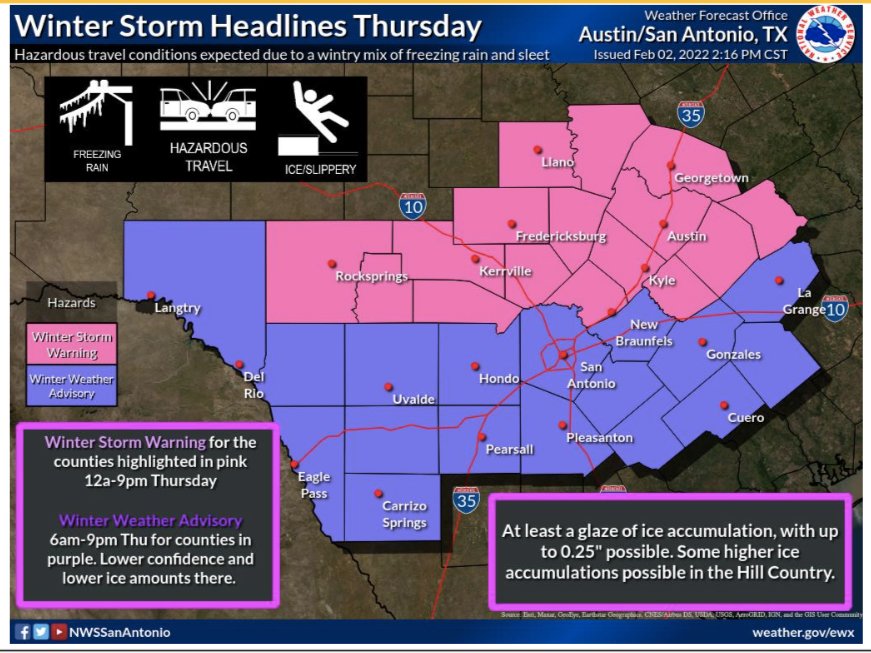
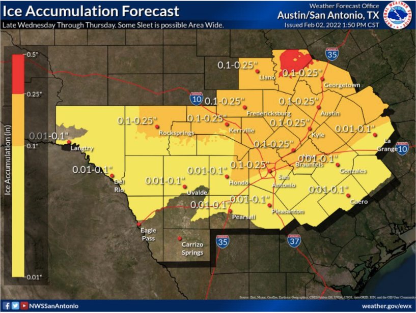
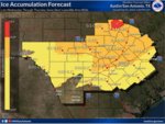
A strong, arctic cold front was on track to move through South Central Texas beginning Wednesday night. Pockets of 1⁄4 to 1⁄2 inch of sleet accumulation across the Hill Country were expected, with increasing confidence of up to 1/10 of an inch of ice as far south as a Del Rio to southern San Antonio to Gonzales line.
Travel could be very difficult on untreated roads, especially elevated bridges, overpasses, and roadways, across the Hill Country and Austin metro area Thursday, and pavement could be slippery to walk on. Some minor travel impacts are possible as far south as a Del Rio to southern San Antonio to Gonzales line on Thursday.
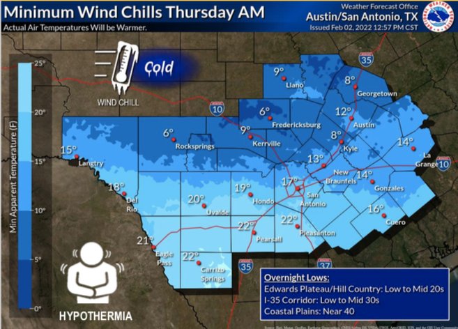
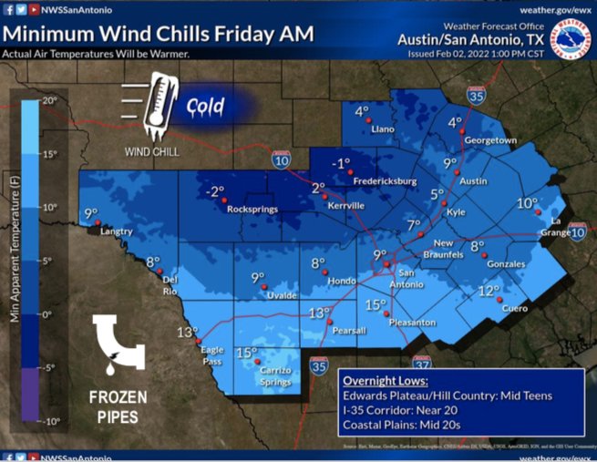
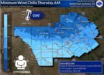
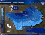
Temperatures will continue to fall across South Central Texas through the day on Thursday, with locations near and north of a Del Rio to northern San Antonio, to La Grange line reaching the freezing mark by noon. Hard freezes in the low teens to low 20s are forecast Thursday night and Friday night across all of South Central Texas. Minimum wind chill values Thursday through Saturday mornings ranging from the single digits to teens. There also is a chance for isolated power outages.


Comments