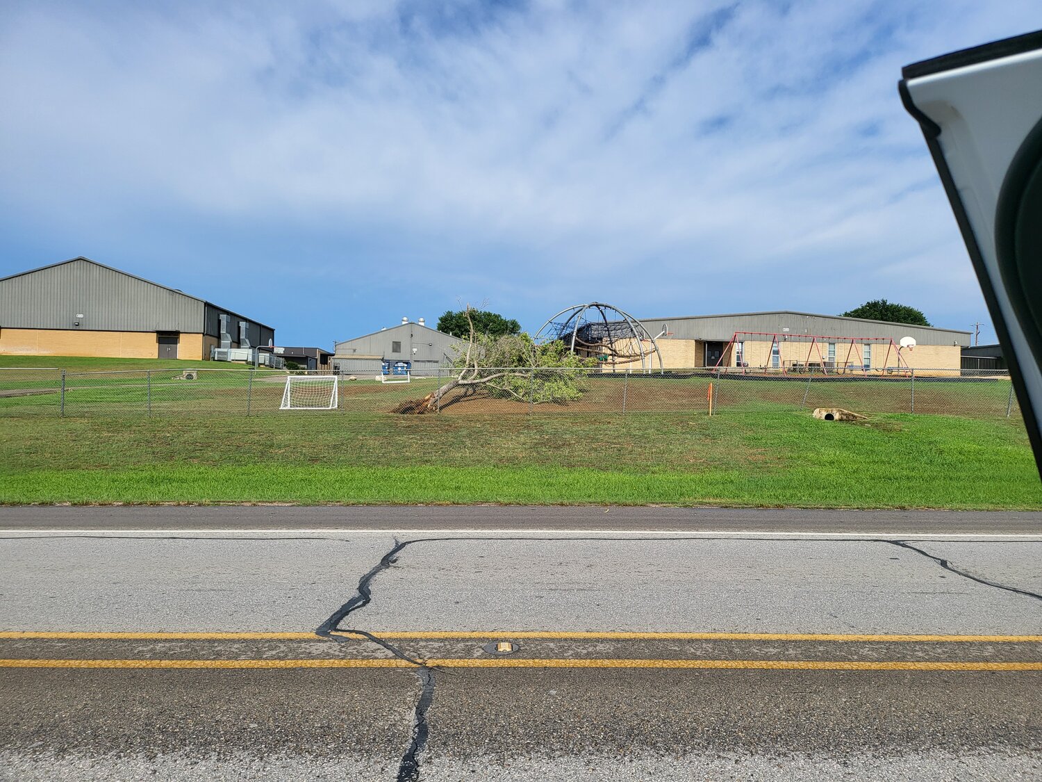
Severe storms damage trees, knock out power for more than 4,000 GVEC customers
Severe weather knocked out electrical power to more than 4,000 GVEC meters while breaking and uprooting a large number of trees in Gonzales County on Monday, May 13.
County Emergency Management and Permitting Director Jimmy Harless said he received word that the National Weather Service had ruled that at one point, an EF-0 tornado did touch ground in the northwest side of Gonzales County, but it was downgraded very quickly as the storm’s structure began to collapse.
“We had a number of tree limbs down and in the roadway and some power outages, but no significant damage to any permanent structures and the hail that was expected petered out over Guadalupe County,” Harless said. “We were very fortunate Monday.”
Straight-line winds with gusts of more than 70 mph snapped trees in the Cost, Bebe, Nixon, Smiley, Pilgrim and Wrightsboro areas. Power was out at the Nixon-Smiley CISD school campuses and at Nixon City Hall for at least an hour and a half and employees at the Circle K in Nixon said at 5 p.m. they had just reopened the store due to an outage that had knocked out their computer systems as well as their electricity.
The hazard light at the intersection of US 183 at Texas 97 by Circle G, Fehner’s and the JB Wells Expo Center was out for a long period of time Monday afternoon and evening. By 2 p.m. Monday, 4,092 outages had been reported in Gonzales County — accounting for 28.1 percent of the total 14,572 meters in the county.
GVEC reported just after 9 p.m. Monday that it had worked to restore power to three substations and to repair approximately eight transmission poles in their territory as winds of up to 70 mph had caused widespread outages in Gonzales County and smaller outages elsewhere.
“Additionally, there are multiple broken poles and damaged or downed power lines after wind blew trees and roofs off buildings, into them,” GVEC said in its statement posted to Facebook. “As of now, we have been able to restore two of the three substations. Restoration efforts are still underway in the Smiley area where outages are still impacting approximately 750 members. We are working around the clock until every member’s power is restored. As of now, the estimated time of total restoration is approximately 15-20 hours.
“We are also patrolling transmission lines to see what other areas we may be able to get back up sooner than the estimated total restoration time. Rest assured, we will continue working diligently, as quickly and safely as possible, until all of our members regain power to their homes, businesses and other meter locations.”
By midnight, the number of outages had reduced to 1,216 or 8.3 percent of total accounts and by 6 a.m. Tuesday, May 14, just 77 meters were still out, or only 0.5 percent of the total accounts in Gonzales County. By 9 p.m. Tuesday, that number was down to just 10 meters out.
Early Monday, the National Weather Service had issued a Severe Thunderstorm Watch until 4 p.m. for Gonzales County with primary hazards expected to be very large hail up to three inches in diameter and damaging wind gusts up to 70 mph.
At 12:59 p.m., NWS issued a severe thunderstorm warning for Gonzales County, until 2 p.m. after severe thunderstorms were radar-indicated along a line extending from 10 miles northwest of Smiley to near Nixon, moving east at 45 mph and gusting up to 60 mph with torrential rainfall. They warned of possible damage to roofs, siding and trees and potential for hail.
By 1:14 p.m., the storms were observed along a line extending from 12 miles southwest of Gonzales to near Smiley, moving east at a speed of 45 mph, and gusts had reached 70 mph. By that time, emergency management had notified of trees down between Nixon and Smiley. The warning said to “expect considerable tree damage. Damage is likely to mobile homes, roofs, and outbuildings.”
“This is a dangerous situation,” the NWS stated in an alert. “These storms are producing widespread wind damage across western Gonzales County. Seek shelter now inside a sturdy structure and stay away from windows.
“Torrential rainfall is occurring with these storms, and may lead to flash flooding. Do not drive your vehicle through flooded roadways.”
By 1:31 p.m., trained weather spotters had noted the severe thunderstorms were locatde along a line extending from Gonzales to near Hochheim to near Westhoff, moving east at 55 mph. The storm had moved out of Gonzales County by 2 p.m.
Comments


